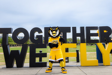
SPSU Honors Program

Caving Adventure '04

About Pigeon Mountain

Pigeon Mountain (see attached map) and Lookout Mountain form a V, like the thumb and index finger of a person's left hand held palm down, with Lookout being the index finger and Pigeon being the thumb. Nestled in the V shape is the Chickamauga Valley 's lovely McLemore Cove, a National Historic District. The northern tip of Pigeon Mountain lies about 3 miles west of LaFayette and stretches southwest for 10 miles, where it joins with Lookout Mountain . The mountain was named for the passenger pigeon, now extinct, which in the 1800s roosted there by the thousands. In the 1920s and 1930s some 30 families lived on Pigeon Mountain , working small farms and perhaps making moonshine liquor. Their names have stayed behind as part of the landscape, as in Rape Gap, Ellison's Cave, and Pettijohn's Cave. The 1930s saw a lowering of the water table on the mountain, causing all the wells to dry up and the families to abandon their homes. The water table has yet to return to its former level.

This is an area with many natural features of exceptional value for wildlife, recreation, and historical, archeological, and educational purposes. For years it has been studied by scientists, who are still finding new and exciting plants, animals, and natural environments. Some 21 rare plants and several rare salamanders are found here. The area was leased by the Georgia Department of Natural Resources in 1969. Since that time, the state has purchased more than 13,000 acres of the mountain. The land is managed as the Crockford–Pigeon Mountain Wildlife Management Area, primarily for wildlife and the protection and enhancement of the mountain's many natural features.

  • Activities: Hiking, caving, rock climbing, hang gliding, all-terrain bike riding, horseback riding, primitive camping, hunting, and fishing.
  • For more information: The Georgia Department of Natural Resources, 2592 Floyd Springs Road NE , Armuchee , GA 30105 . Phone (706) 295-6041.

Caves of Pigeon Mountain

Like Lookout Mountain , Pigeon Mountain is laced with caves that wind all through the limestone rock. There are many cave entrances on the mountain, and it is an important location for cavers throughout the Southeast. Ellison's Cave contains two exceptionally deep pits—Fantastic Pit at 586 feet and Incredible Dome Pit at 440 feet. About 13 miles of Ellison's Cave have been explored and mapped. In fact, it is likely that Pigeon Mountain is a vast system of underground caverns and stream channels. Pettijohn's Cave was first described in 1837. Approximately 6 miles of passageways in this cave have been mapped, and new passages are still being discovered. This cave has seen much more use than Ellison's and has sustained more damage to its mineral formations.

It should be emphasized also that the underground can be an extremely dangerous area to explore for individuals unfamiliar with the skills required in caving. Caves should be explored only in the company of well-equipped, experienced cavers.

  • For more information: Because of the danger of caving and the fragile nature of caves, directions are not provided. For information on the sport of caving, contact the National Speleological Society, 2813 Cave Avenue , Huntsville , AL 35810-4431 . Phone (205) 852-1300. Fax (205) 851-9241. E-mail nss@caves.org . World Wide Web http://www.caves.org

ROCKTOWN TRAIL: 1 mile one-way. Exploration of the massive boulders within the 150 acres of Rocktown can easily consume the better part of a day. The biggest mistake visitors can make is not to allow enough time to inspect this unusual site. Some of the boulders are as large as three-story office buildings; a narrow pedestal supporting a caprock resembles a 25-foot-tall champagne glass; and deep inside a narrow, dark crevice it is cool enough for hikers to see their breath even though the outside temperature may be close to 80 degrees Fahrenheit.

The reddish rocks of this ancient river delta that hikers see along the trail or imbedded in the sandstone formations of Rocktown are iron ore deposits. At one time there were 10 iron mines on the mountain. These deposits add a special visual interest to the Rocktown environment, because the softer sandstone erodes around them. Rocktown is easy to reach and would be a suitable hike for those of almost any age or physical condition. Children could, however, accidentally stray from the trail. The trail is marked with pink blazes.

  • Directions: From US 27 in LaFayette, go west 2.8 miles on GA 193 to Chamberlain Road ; turn left and go 3.4 miles; turn right (marked by a wooden sign for Crockford–Pigeon Mountain WMA). Pass the Department of Natural Resources's check station and continue straight on the gravel road. Where the road forks, 4.2 miles from the check station, continue on the right fork. Past some cleared fields on the left, there is a good gravel road to the left 1.3 miles after the fork. Turn left there and go .7 mile to a clearing near the trailhead.

This and further information is contained at Sherpaguides.com.

Caving Adventure Home Page
About Pigeon Mountain
Liability Waiver